![]()
Last updated 2007.11.21
- Tanzania is situated on the eastern coast of Africa just south of the equator
- Area: 945.000 km2 (mainland: 881.000) ~ ca. 19 times as large as Danmark
- Population (estimated 2002): 33 millions
- Tanzania is among the poorest countries in the world, GNP/capita (estimated 2001): 246 $
- The highest point in Africa, Mount Kilimanjaro, is situated in Tanzania close to the city Moshi just south of the Kenyan border
- The lowest point in Africa is also situated in Tanzania, at the bottom of Lake Tanganyika, some 350 m below sea level
- The islands Zanzibar, Pemba, Mafia and the whole archipelago has been an arab sultanate
- Under the name German East Africa the mainland part (Tanganyika) was under German jurisdiction until World War 1
- After WW1 Tanganyika became et british protectorate
- Tanganyika gained independence in 1962 and united with the sultanate Zanzibar under the name Tanzania
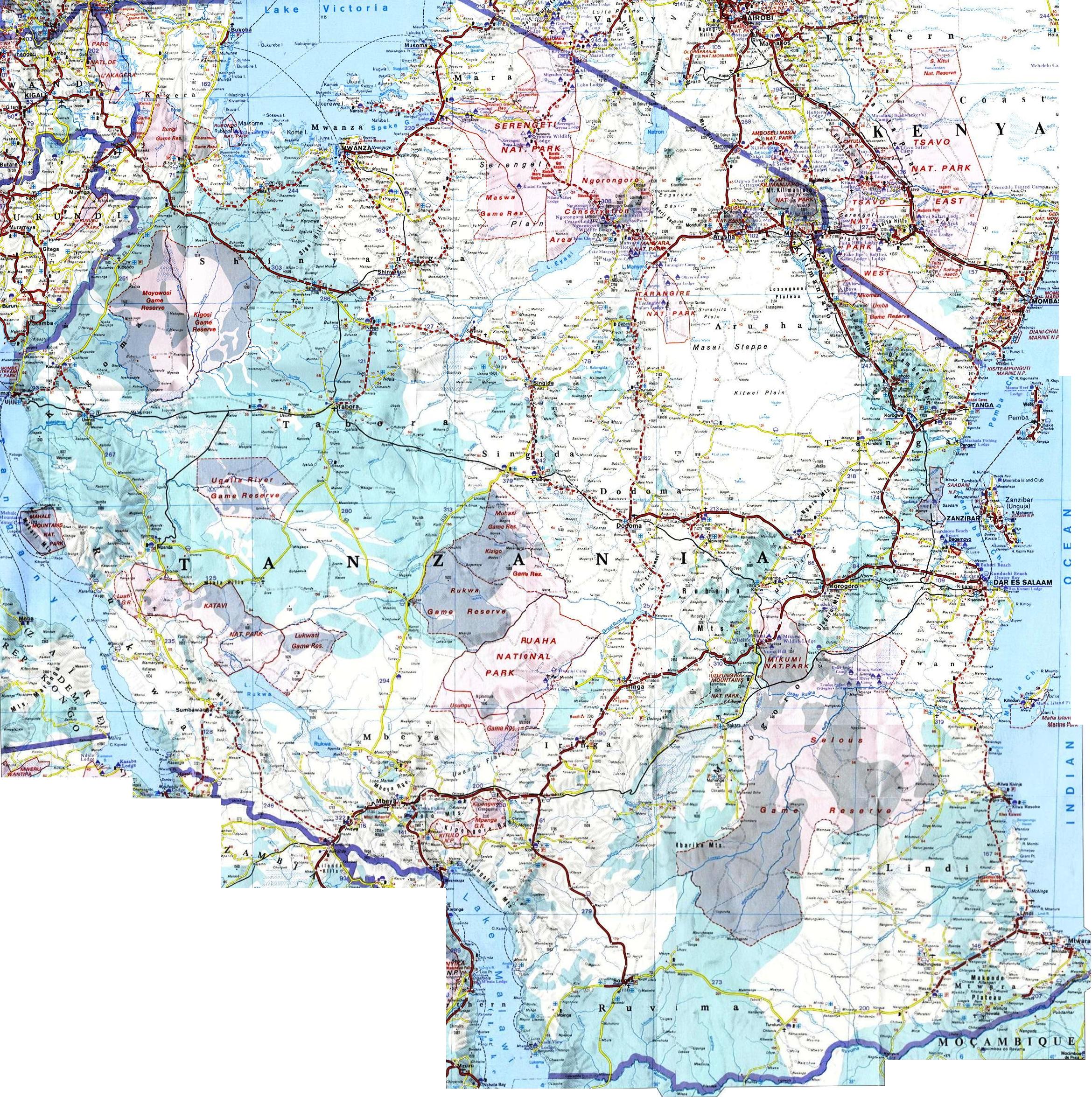
- Close to 25 % of the area of Tanzania is under some kind of protection, as national parc, "Conservation Area" eller "Game Reserve"
- Capital: Dodoma
- Largest cities: 1. Dar es Salaam, 2. Mwanza
- Flag:

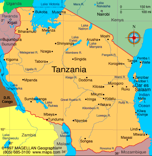
Click on the map above to see a more detailed map of that part of Tanzania (150 - 300 kb). Click here to see a large and detailed map (1.4 Mb).
Links:
- Officiel website of Tanzania: http://www.tanzania.go.tz/
- National parcs of Tanzania: http://www.tanzaniaparks.com/
- About Jane Goodall and the chimpanzee at Gombe Stream: http://www.janegoodall.org/
- Our tour operator Scantan: http://www.scantantours.dk/